Much of Laval sits on the Champlain Sea clay plain, a post-glacial marine deposit that can extend over 30 meters deep in some areas near the Rivière des Mille-Îles. This sensitive silty clay, locally known as Leda clay, presents unique challenges when undisturbed samples are needed for laboratory strength testing. In our experience across Laval—from the commercial corridors of Chomedey to the industrial zones of Saint-Vincent-de-Paul—an exploratory test pit often provides the most reliable method for observing the transition between the weathered crust and the intact clay beneath. Unlike boreholes that retrieve small-diameter samples, a properly logged test pit allows the geotechnical engineer to walk the full profile, measure jointing in the underlying limestone bedrock where it outcrops, and collect large bulk samples for Proctor compaction testing when the project involves engineered fill placement. The water table in Laval is frequently encountered within 2 to 4 meters of the surface, and the pit walls in these saturated clays must be carefully evaluated for short-term stability before any technician enters the excavation.
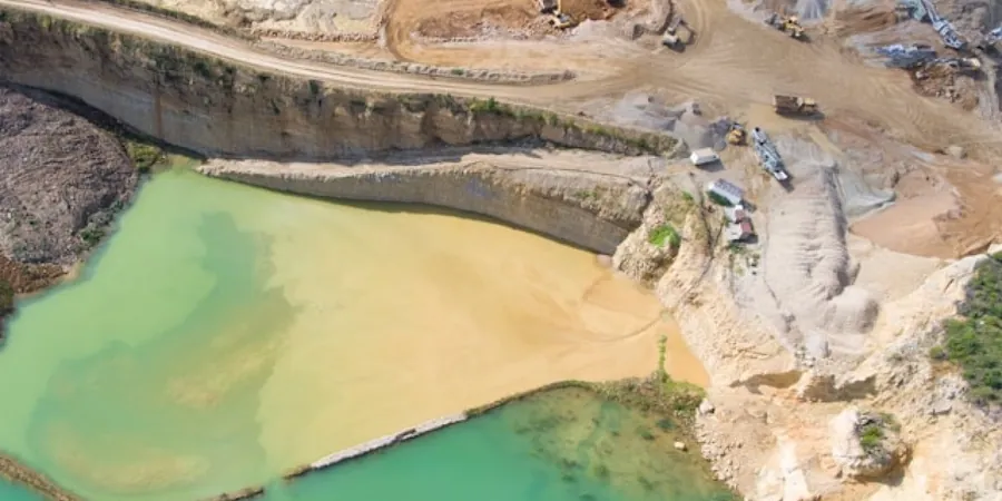
Seeing the Chalmplain clay profile in a full-depth test pit reveals oxidation zones and shear planes that no borehole log can capture completely.
Methodology and scope
The freeze-thaw cycle in Laval, with winter lows regularly dipping below -20°C and spring thaws saturating the ground, creates a highly active zone in the upper 1.5 to 2.0 meters of soil. This seasonal movement can mask deeper stratigraphic issues if the investigation stops at shallow depths. An exploratory test pit in this region is typically advanced through the silty sand veneer left by the retreat of the Laurentide Ice Sheet, then into the underlying Champlain clay. We log the depth of oxidation, which in Laval often reaches 3 to 4 meters, and document the transition from stiff fissured clay to softer intact material. For sites in eastern Laval where granular deposits from the Saint Lawrence River paleo-channels appear, we combine the pit investigation with
in-situ permeability testing to estimate hydraulic conductivity directly from the exposed face. Where limestone bedrock is encountered at shallow depth—common in the Pont-Viau area—the pit becomes a critical tool for assessing rock quality designation (RQD) and fracture spacing before designing
shallow footings. The ASTM D2488 visual-manual procedure guides our field classification, and we routinely collect Shelby tube samples from the pit floor when the depth to competent material exceeds the safe limits of vertical open cuts.
Local considerations
In Laval, the most frequent issue we encounter is the misidentification of the weathered crust as a competent bearing stratum. The upper 2 to 3 meters of Champlain clay are often stiff and fissured, leading some to assume it can support spread footings without deeper investigation. However, the underlying soft intact clay, when loaded, can undergo long-term consolidation settlement that damages lightly reinforced structures. A test pit that stops at 2 meters misses this critical transition. Another local risk involves uncontrolled groundwater inflow. In low-lying sectors of Laval near the Rivière des Prairies, the water table can rise rapidly in spring, destabilizing pit walls that appeared stable during excavation. We have observed near-vertical cuts in silty clay that slough without warning after a few hours of exposure to air and moisture. Proper shoring or benching per CNESST safety codes is mandatory, and no one should enter a pit deeper than 1.2 meters without a competent person assessing the soil classification and stability. The presence of sensitive clay also demands caution: vibration from nearby traffic on Autoroute 15 or Autoroute 440 can trigger remolding in saturated Leda clay, reducing its shear strength to nearly zero in a localized failure.
Frequently asked questions
What is the typical cost range for an exploratory test pit in Laval?
For a standard exploratory test pit in Laval—including backhoe excavation to 3.5 meters, full ASTM D2488 logging by a geotechnical engineer, bulk sampling, and backfill compaction—the cost typically ranges from CA$670 to CA$990 per pit. The final price depends on access conditions, the need for hydrovac excavation in congested utility corridors, and the number of Shelby tube samples collected from the pit floor. Projects requiring multiple pits on the same site benefit from mobilization efficiency.
How deep can an exploratory test pit go in Laval's Champlain clay?
In the Champlain clay that underlies much of Laval, we typically limit vertical cuts to 4 meters in Type C soil per CNESST safety regulations. For deeper investigations, we bench the excavation or slope the sides at a ratio of 1.5:1. If the water table is encountered within the first 2 meters, the practical depth is often reduced due to seepage-induced instability. In those cases, we may combine the test pit with an adjacent SPT borehole to extend the investigation depth.
What information does a test pit provide that a borehole cannot?
A test pit provides a continuous, full-scale exposure of the soil profile, which a borehole cannot replicate. The geotechnical engineer can observe macro-structural features such as fissures, oxidation stains, shear planes, and root penetration that are invisible in split-spoon samples. It also allows for direct measurement of infiltration rates on exposed soil horizons and the collection of large, undisturbed block samples. For projects involving retaining wall design in Laval, seeing the actual backfill material and its layering is invaluable.
How are test pit locations selected for a site investigation in Laval?
Pit locations are selected based on the proposed structure footprint, the results of a desk study that includes historical maps of the Champlain Sea extent, and the variability observed in prior geotechnical reports for the neighborhood. In Laval, we often place pits at the corners of the planned building and one in the center to capture lateral changes in the clay crust thickness. If the site is near a former watercourse or marsh—common in the eastern sectors—we target those areas to identify organic deposits that would not be detected by widely spaced boreholes.