The stainless-steel packer assembly arrives at the Laval jobsite looking deceptively simple for the data it delivers. A technician lowers the cylindrical tool down the drill casing to the test depth, inflates the rubber seals to isolate the zone, and begins the controlled water injection. In the limestone and shale that underlie much of Laval—where the Rivière des Prairies shapes the local water table—knowing the difference between a tight formation and one riddled with solution channels changes the entire project budget. The Lefranc test handles soil and highly fractured rock with a simple falling-head principle, while the Lugeon method applies stepped pressure stages to assess rock mass conductivity. Both provide the hydraulic conductivity values that drainage contractors and foundation engineers need before designing excavation support or permanent dewatering systems. For deeper investigations where stratigraphy is unclear, our team often runs a preliminary seismic refraction survey to map bedrock depth before positioning permeability test intervals.
A single Lugeon test in fractured limestone can reveal more about excavation risk than a dozen undisturbed samples tested in the lab.
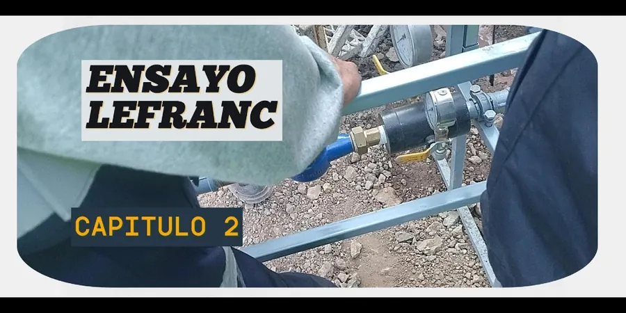
Methodology and scope
A mistake we see repeatedly in Laval is assuming a uniform permeability coefficient from desktop geology maps. The reality on the ground—especially near the old quarry zones in the eastern part of the island—is that a single borehole can pass through three distinct hydraulic regimes in fifteen meters. A contractor who skips field testing and relies on textbook values for glacial till will undersize their sump pumps and flood the excavation on day one. The Lefranc protocol captures point measurements in soil at the base of a borehole, using either constant-head or variable-head procedures depending on expected flow rates. The Lugeon test, developed for dam foundations, pumps water into an isolated rock interval at up to five pressure steps, generating a characteristic pressure-flow curve that reveals whether fractures are dilating, washing out, or sealing under load. This data feeds directly into steady-state seepage models and helps determine whether cut-off walls, grout curtains, or simple wellpoints are the right solution. The equipment is calibrated to ASTM D4630 for rock mass permeability, and our lab maintains ISO 17025 accreditation for the pressure transducer and flow meter systems used in the field.
Local considerations
Laval sits at roughly 45 meters above sea level on Île Jésus, with a population approaching 450,000 that continues pushing development into areas where the till cover is thin and the underlying Ordovician limestone is hydraulically active. The last significant seismic event affecting the region was the 2010 Val-des-Bois earthquake, a magnitude 5.0 that reminded engineers across the St. Lawrence lowlands that the Western Quebec Seismic Zone is very much alive. In a dewatering context, the bigger daily risk is not shaking but uncontrolled groundwater inflow through karstic features. A foundation pit that intersects an open fracture network connected to the Rivière des Mille Îles can fill faster than any pump can empty it. Field permeability testing identifies these high-conductivity zones before the backhoe bucket ever touches them. The Lugeon value—interpreted as the water loss in litres per minute per metre of test interval at one MPa of pressure—gives a direct, repeatable metric that geotechnical engineers use to decide whether grouting is needed and at what pressure the rock mass will accept it without hydraulic fracturing.
Frequently asked questions
How much does a field permeability test cost in Laval?
A single Lefranc or Lugeon test in Laval typically ranges from CA$830 to CA$1,490 per test interval, depending on depth and whether a single or double packer setup is required. Mobilization, drill rig standby, and reporting are usually quoted separately. For multi-level testing programs, per-interval pricing becomes more competitive.
When should I choose a Lugeon test instead of a Lefranc test?
The Lugeon test is designed for competent rock where you need to assess the hydraulic conductivity of discrete fracture systems under pressure. It is the right choice when excavating in the limestone bedrock common across Laval. The Lefranc test is better suited for soil, heavily weathered rock, or backfill where the borehole wall will not support packer inflation pressure without collapsing.
How long does a typical permeability test take on site?
A single Lugeon test with five pressure stages takes about 60 to 90 minutes once the packer is set. A Lefranc variable-head test in soil can be completed in 30 to 45 minutes. The biggest variable is drill rig time—cleaning the borehole, advancing casing, and setting the packer at the correct depth adds several hours per setup.
What data do I receive after the test?
You receive a signed and stamped report that includes the test interval depths, raw pressure and flow rate data, calculated hydraulic conductivity (K in cm/s or m/s), Lugeon values where applicable, and pressure-flow interpretation plots. We also provide recommendations for dewatering flow rates and comments on whether grouting appears necessary.
Can these tests be combined with other site investigation work?
Absolutely. The same drill rig used for SPT sampling or rock coring can be used for packer testing on the same day. We coordinate with the drilling contractor so that permeability tests are performed immediately after the borehole reaches target depth and before grout or casing is installed, saving you a separate mobilization.